May 20, 2021
(en español)
In 2020, as a part of the Bloomberg Initiative for Global Road Safety (BIGRS) program, NACTO-GDCI began working with the city of Quito, Ecuador with the ambition of improving road safety, reducing injuries and deaths on the roads, and helping the city to design for safer and more inclusive streets.
Beginning in mid-2020, NACTO-GDCI began supporting EPMMOP (Quito’s public works agency) with the design, development, and implementation process of street design improvements in the neighborhood of La Magdalena. The project forms a key part of the “Crash Spots” program, which seeks to implement quick-build street redesign projects in neighborhoods that are experiencing the highest levels of traffic-related injuries and fatalities.
La Magdalena
The historic neighborhood of La Magdalena sits just south of the city center and forms a vibrant community with a high-density, mixed-use character. The area is home to many key community amenities, including a bustling market and multiple schools. At the heart of the neighborhood, “Iglesia La Magdalena” overlooks the central “Plaza Magdalena.”
The area is currently served by the BRT system and extensive local bus routes, which are set to be complemented by the opening of the La Magdalena Metro station within the next year. The investment in new public transit infrastructure further underscores the importance of providing safe walking and cycling routes for those accessing public transit.
Many residents and workers within the neighborhood rely on the BRT station located on the adjacent corridor of Av Mariscal Sucre. A highly frequented pedestrian route follows the street of Viracocha, connecting the plaza La Magdalena to the BRT stop on Av Mariscal Sucre. The corridor was identified as featuring both inadequate facilities for pedestrians and high vehicle speeds that had led to a higher than average road crash rate. Between 2017 and 2020, Agencia Metropolitana de Tránsito (AMT) recorded 39 crashes within the area.
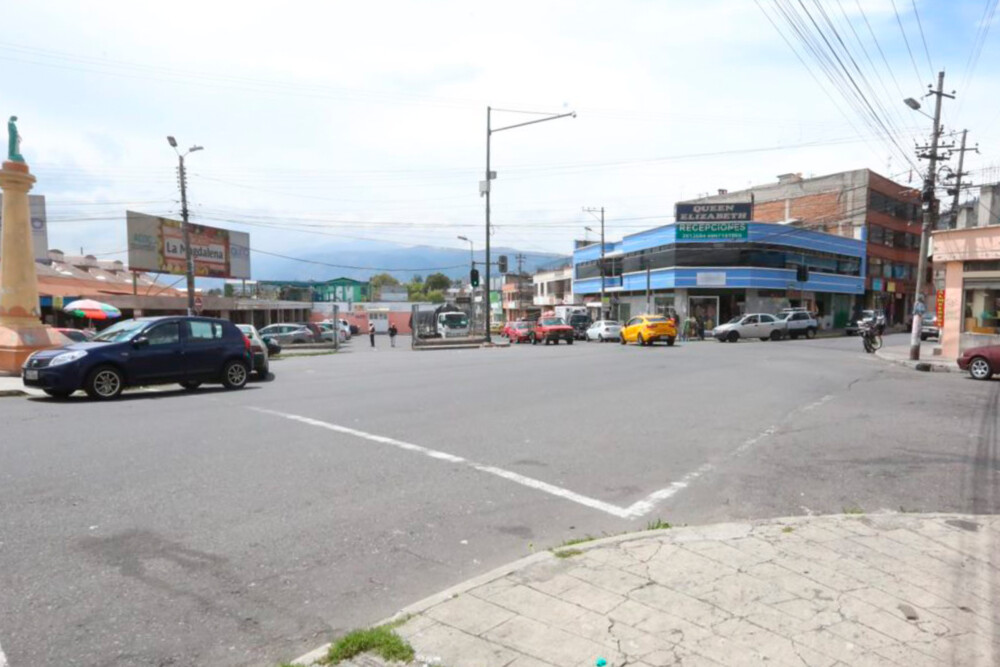
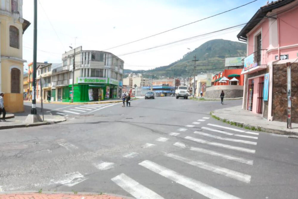
EPMMOP identified a number of design issues on Virachocha and the surrounding streets that potentially contributed to the area’s high crash rate. Sidewalks are inconsistent in width, often narrowing to below 1m in places. Extremely narrow sidewalks can force pedestrians into the roadbed, exposing them to speeding traffic, and widths of below 1.8m are almost entirely inaccessible for those using wheelchairs or other mobility aids.
Excessively wide vehicle travel lanes and long, straight, uncontrolled stretches of street contributed to high average vehicle speeds. Intersections were designed to be very wide, with excessive corner radii and the provision of slip lanes. These design elements led to vehicle speeds remaining high within the intersection, and they created long crossing distances for pedestrians. Informal parking was also common on both sides of the street at critical locations, resulting in pedestrians wishing to cross being obscured by parked cars.

Design & Implementation
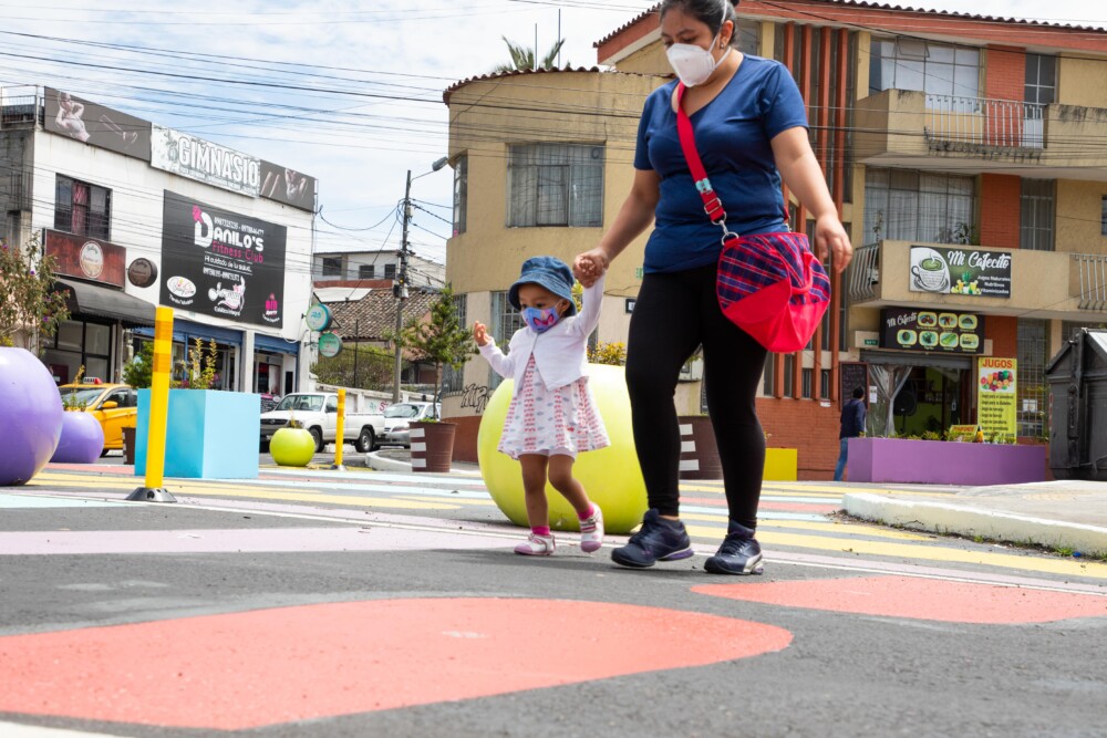
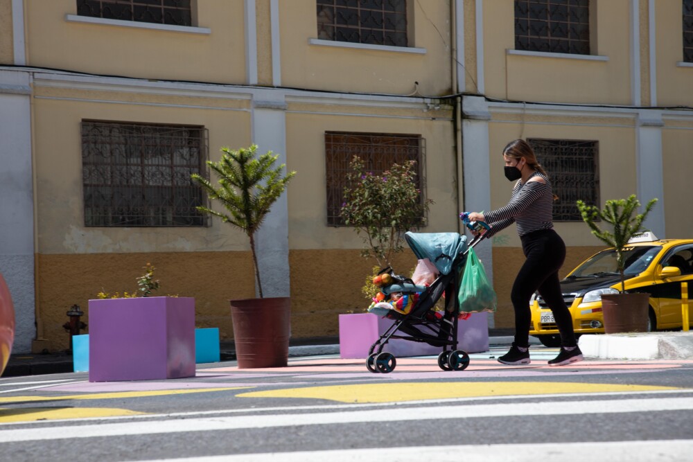
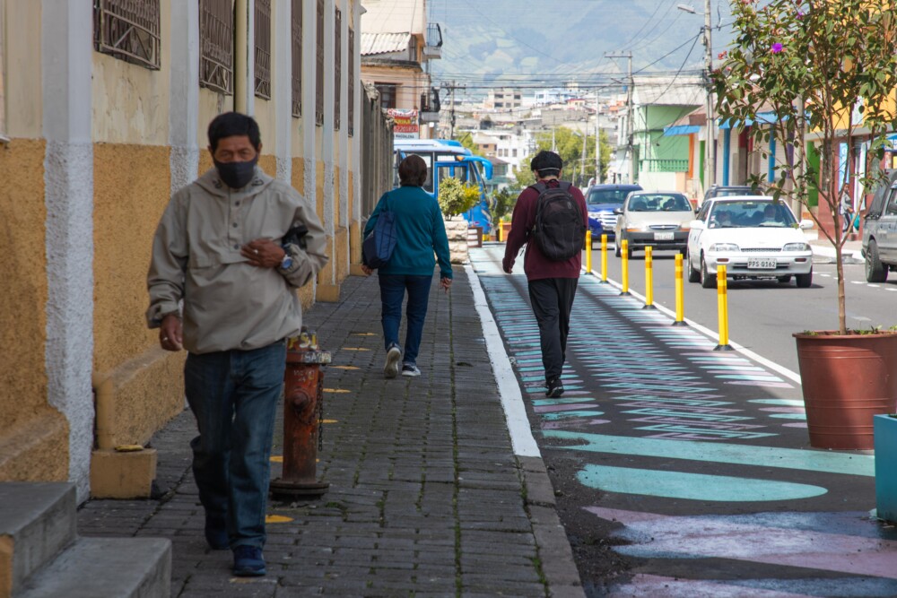
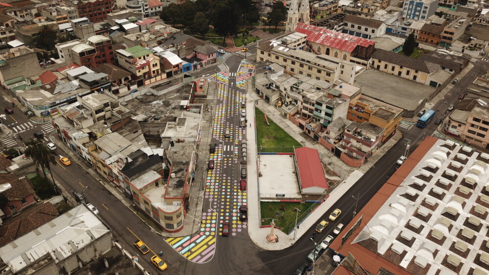
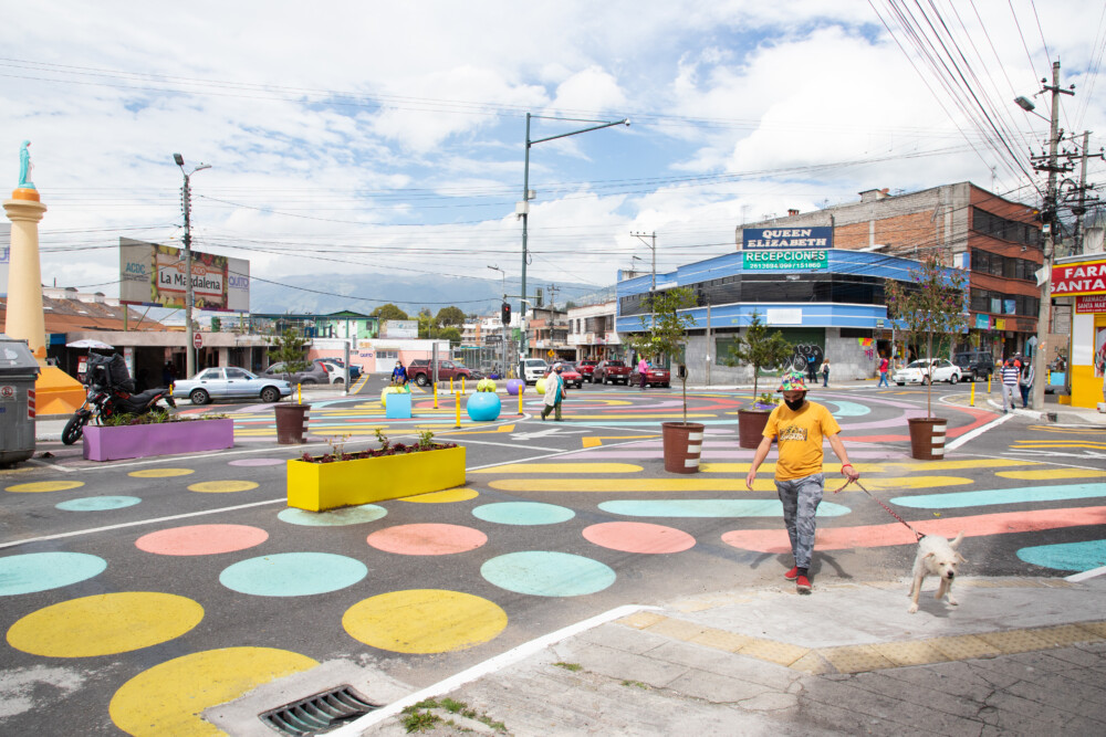
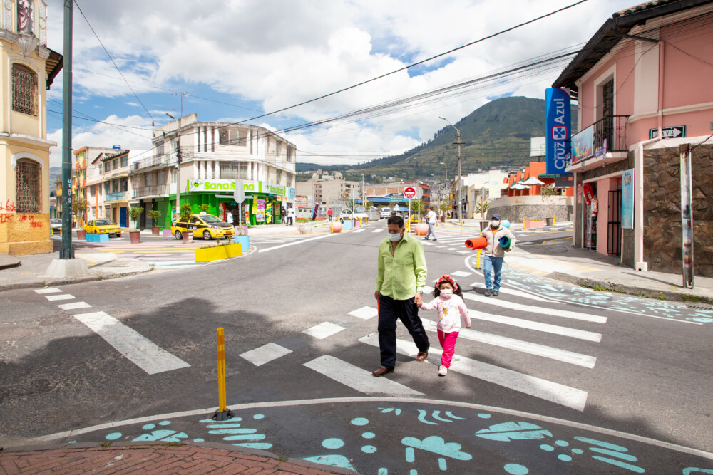
A total of 1.8km of streets were improved, with a focus on improving pedestrian safety. This was achieved by expanding sidewalks across the site to provide 4300 m2 of new pedestrian space and 15 newly marked pedestrian crosswalks. Informal parking adjacent to crosswalks was reclaimed as sidewalk extensions in order to improve the visibility of pedestrians crossing and reduce crossing distances.
Vehicle speed is the greatest determinant of the severity of a crash, so the project also sought to slow vehicle speeds comprehensively. Since travel lane width is one of the biggest determinants of vehicle speed, travel lanes were narrowed to a maximum of 3.5m throughout the site in order to achieve slower speeds. In addition, turning radii were reduced at 16 intersections in order to force vehicles to turn at a slower speed, while modular speed humps were placed before several crosswalks as a way to increase the rate of yielding to pedestrians.
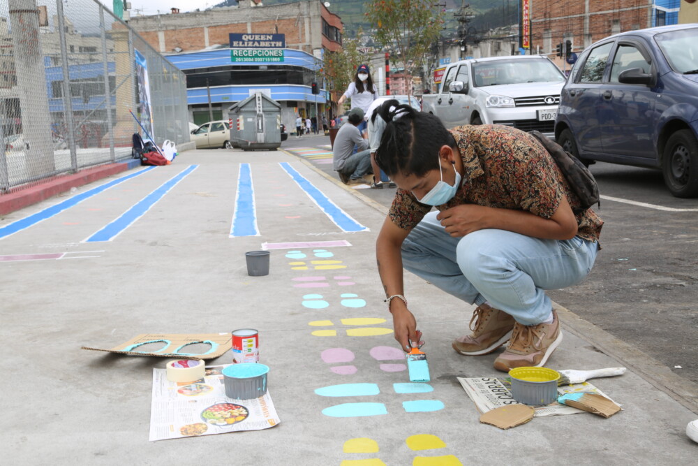
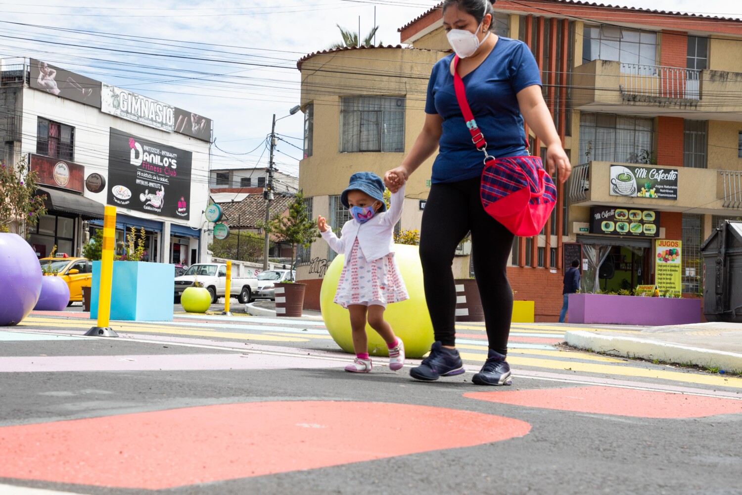
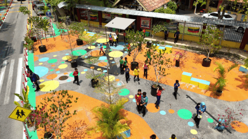
As part of the project’s community-driven design process, a local artist was hired to design the pattern painted across the site. The striking, vibrant design drew inspiration from colors and patterns associated with the history and culture of the neighborhood. Rather than just painting the new pedestrian spaces, the design was extended into the roadbed, to create a sense of “shared space” and further slow vehicle speeds.

Community Response
Community engagement was a central focus at every stage of this process; the city thought creatively about how to introduce project concepts to the community early on, throughout the pandemic. Despite great challenges posed by COVID-19, the team conducted site observations and data collection in person and through drone video footage in order to better understand the issues. EPMMOP then began an iterative design process with extensive involvement of the community and key stakeholders, hosting virtual town halls in which community members were able to vote on their preferred designs. The team felt it was essential to provide the much-needed safety improvements, while also allowing the community to influence the design to as great an extent as possible.
After the implementation was complete, the team organized a “minga” in which residents and members of the community walked through the site together, cleaning up the streets and building a sense of connection and ownership of the project. Another key priority of the team was to understand and evaluate the community’s responses to the project. To do this, they conducted surveys with local residents and posted public boards encouraging passersby to comment on whether or not they liked the designs.
One area of particular concern voiced by the community was the impact the project might have on the local market since the design would involve removing some on-street parking as well as narrowing lanes frequented by trucks serving the market. Additional in-person meetings and consultations were conducted with stakeholders associated with the market in order to ensure that the design met their needs, whilst balancing them against the need for safety improvements. After taking this feedback into consideration, one result of this engagement was the launching of an “economic improvement program” designed to alleviate the concerns of traders.
The collaborative nature of the process was internally focused as well. EPMMOP liaised extensively with other agencies including the Secretary of Public Health, the Secretary of Mobility, and the Secretary of Tourism to allow for the Quito tourist bus to pass through this neighborhood to increase sales in the market.
Overall, the project has been received positively, with 68% of respondents feeling it was safer to cross the road after the intervention as well as 50% feeling very safe or quite safe walking after the implementation. In general, it was agreed that the new design was much better for pedestrians.

——————–
This collaboration between NACTO’s Global Designing Cities Initiative and the City of Quito, Ecuador is made possible thanks to generous support from the Bloomberg Philanthropies Initiative for Global Road Safety (BIGRS).
Written by Najwa Doughman, Annah MacKenzie, Alejandra Sandoval
Designed by Solomon Green-Eames
Please contact najwa@nacto.org with inquiries related to this project.
