-
About Streets
- Introduction
- Defining Streets
-
Shaping Streets
- The Process of Shaping Streets
- Aligning with City and Regional Agendas
- Involving the Right Stakeholders
- Setting a Project Vision
- Communication and Engagement
- Costs and Budgets
- Phasing and Interim Strategies
- Coordination and Project Management
- Implementation and Materials
- Management
- Maintenance
- Institutionalizing Change
- Measuring and Evaluating Streets
-
Street Design Guidance
- Designing Streets for Great Cities
- Designing Streets for Place
-
Designing Streets for People
- Utilities and Infrastructure
- Operational and Management Strategies
- Design Controls
-
Street Transformations
- Streets
-
Intersections
- Intersection Design Strategies
- Intersection Analysis
- Intersection Redesign
- Mini Roundabout
- Small Raised Intersection
- Neighborhood Gateway Intersection
- Intersection of Two-Way and One-Way Streets
- Major Intersection: Reclaiming the Corners
- Major Intersection: Squaring the Circle
- Major Intersection: Cycle Protection
- Complex Intersection: Adding Public Plazas
- Complex Intersection: Improving Traffic Circles
- Complex Intersection: Increasing Permeability
- Resources
Global Street Design Guide
-
About Streets
- Introduction
- Defining Streets
-
Shaping Streets
Back Shaping Streets
- The Process of Shaping Streets
- Aligning with City and Regional Agendas
- Involving the Right Stakeholders
- Setting a Project Vision
- Communication and Engagement
- Costs and Budgets
- Phasing and Interim Strategies
- Coordination and Project Management
- Implementation and Materials
- Management
- Maintenance
- Institutionalizing Change
-
Measuring and Evaluating Streets
Back Measuring and Evaluating Streets
-
Street Design Guidance
-
Designing Streets for Great Cities
Back Designing Streets for Great Cities
-
Designing Streets for Place
Back Designing Streets for Place
-
Designing Streets for People
Back Designing Streets for People
- Comparing Street Users
- A Variety of Street Users
-
Designing for Pedestrians
Back Designing for Pedestrians
- Designing for Cyclists
-
Designing for Transit Riders
Back Designing for Transit Riders
- Overview
- Transit Networks
- Transit Toolbox
-
Transit Facilities
Back Transit Facilities
-
Transit Stops
Back Transit Stops
-
Additional Guidance
Back Additional Guidance
-
Designing for Motorists
Back Designing for Motorists
-
Designing for Freight and Service Operators
Back Designing for Freight and Service Operators
-
Designing for People Doing Business
Back Designing for People Doing Business
-
Utilities and Infrastructure
Back Utilities and Infrastructure
- Utilities
-
Green Infrastructure and Stormwater Management
Back Green Infrastructure and Stormwater Management
-
Lighting and Technology
Back Lighting and Technology
-
Operational and Management Strategies
Back Operational and Management Strategies
- Design Controls
-
Street Transformations
-
Streets
Back Streets
- Street Design Strategies
- Street Typologies
-
Pedestrian-Priority Spaces
Back Pedestrian-Priority Spaces
-
Pedestrian-Only Streets
Back Pedestrian-Only Streets
-
Laneways and Alleys
Back Laneways and Alleys
- Parklets
-
Pedestrian Plazas
Back Pedestrian Plazas
-
Pedestrian-Only Streets
-
Shared Streets
Back Shared Streets
-
Commercial Shared Streets
Back Commercial Shared Streets
-
Residential Shared Streets
Back Residential Shared Streets
-
Commercial Shared Streets
-
Neighborhood Streets
Back Neighborhood Streets
-
Residential Streets
Back Residential Streets
-
Neighborhood Main Streets
Back Neighborhood Main Streets
-
Residential Streets
-
Avenues and Boulevards
Back Avenues and Boulevards
-
Central One-Way Streets
Back Central One-Way Streets
-
Central Two-Way Streets
Back Central Two-Way Streets
- Transit Streets
-
Large Streets with Transit
Back Large Streets with Transit
- Grand Streets
-
Central One-Way Streets
-
Special Conditions
Back Special Conditions
-
Elevated Structure Improvement
Back Elevated Structure Improvement
-
Elevated Structure Removal
Back Elevated Structure Removal
-
Streets to Streams
Back Streets to Streams
-
Temporary Street Closures
Back Temporary Street Closures
-
Post-Industrial Revitalization
Back Post-Industrial Revitalization
-
Waterfront and Parkside Streets
Back Waterfront and Parkside Streets
-
Historic Streets
Back Historic Streets
-
Elevated Structure Improvement
-
Streets in Informal Areas
Back Streets in Informal Areas
-
Intersections
Back Intersections
- Intersection Design Strategies
- Intersection Analysis
- Intersection Redesign
- Mini Roundabout
- Small Raised Intersection
- Neighborhood Gateway Intersection
- Intersection of Two-Way and One-Way Streets
- Major Intersection: Reclaiming the Corners
- Major Intersection: Squaring the Circle
- Major Intersection: Cycle Protection
- Complex Intersection: Adding Public Plazas
- Complex Intersection: Improving Traffic Circles
- Complex Intersection: Increasing Permeability
- Resources
- Guides & Publications
- Global Street Design Guide
- Designing Streets for Place
- Local and Regional Contexts
Local and Regional Contexts

Demographics
Analyze who lives, works, and visits the area. Identify areas with high proportions of vulnerable populations such as seniors, children, people with disabilities, or those disadvantaged through other socio-economic factors.
Work with local constituents to ensure that a street project reflects and supports citywide goals and community priorities.

Density
Analyze population densities, including the number of residents and concentration of jobs. Note their geographic locations and analyze trends and projections to understand future change. Document the relationship of densities and access to collective transport.
Support investment in facilities for sustainable mobility to increase the capacity of the street and serve more people.
Prioritize projects that will impact the largest number of people or where the need is the greatest.

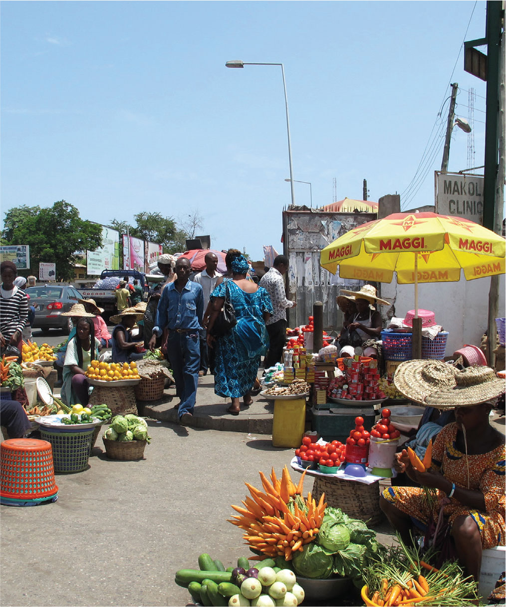
History and Culture
Local culture will impact the nuances of how communities use and relate to their streets.
Identify how local cultures, religions, and historically significant events inform how people behave in public spaces through specific rituals or activities.
Understand each project’s local context to ensure culturally appropriate community engagement processes and project outcomes.
Consider how activities such as markets, vendors, bazaars, cafés, and other cultural activities can enhance a sense of place.

Mix of Uses and Destinations
Identify the mix of land uses and map important destinations that attract large numbers of people, such as job centers, parks, cultural and educational institutions, waterfronts, schools, playgrounds, transit stations, and critical services.
Ensure street networks provide sustainable mobility options between communities and important destinations.
Design streets to serve and attract a diverse set of uses and activities, to enhance adjacent uses, and to become destinations in themselves.

Road Safety
Document existing speed limits, average speed traveled, and areas with high concentration of traffic crashes and fatalities.
Lower speed limits, reduce design speed, propose slow zones, and identify locations to implement traffic calming strategies. Create pedestrian-only spaces, shared streets, or transit malls in suitable contexts.

Public Health
Identify geographic areas with high concentrations of chronic diseases and related hazards such as air, water, or noise pollution, or unattended waste.
Prioritize strategies that reduce pollution and promote clean and active modes of transportation. Designate freight travel routes that avoid residential areas. Ensure all neighborhoods are provided with street cleaning services and facilities, focusing especially on streets with high waste volumes.

Access and Mobility
Measure existing mode share, noting shifts at different times of the day and week. Identify areas that lack access to collective transport, cycle, and pedestrian infrastructure.
Design street networks to support desirable mode share goals. Prioritizing infrastructure investments that ensure walking, cycling, and collective transport are more enticing choices than private car use.
Promote car and bike share programs, develop pricing strategies, and manage networks to achieve desirable mode share targets.

Street Networks and Connectivity
Consider the existing and potential role of each street in the larger network. Note how and where networks for different modes of mobility overlap. Identify critical citywide or regional connections along specific corridors and determine how local needs change with context.
Plan, organize, and retrofit street networks to prioritize direct, safe, and convenient walking, cycling, and collective transport access and connectivity. Support connections between different modes of mobility by providing comfortable facilities at transfer points.

Block Sizes
Measure block sizes in the urban fabric and identify how these impact walkability.
Design new street networks to keep blocks small, promoting a walkable city that offers multiple route options.
Identify where large existing blocks can be broken down in scale with safe and well-designed paths and laneways to increase permeability and connectivity for pedestrians and cyclists.
When large blocks cannot be reduced in size, identify areas where mid-block crossings can increase permeability within neighborhoods.

Ecosystems and Habitats
Identify local ecosystems and areas of ecological importance to be protected and enhanced.
Ensure street networks avoid fragmentation of natural habitats. Support local ecosystems and foster biodiversity by constructing habitats within streets. Provide connectivity through landscaped streets for fauna movement, seed and pollen dispersal, and plant migration.

Natural Disasters
Analyze climate and frequency of extreme weather events, noting areas vulnerable to natural disasters.
Plan local infrastructure and support services to manage droughts, heavy rains, and snow falls.
Consider renewable energy sources for street lighting and emergency services.
Identify strategies and materials to support resilience in areas vulnerable to natural disasters, and designate clearly communicated emergency routes.

Geographic Features
Document topography, water bodies, and other natural features to inform new or transformed street patterns.
Encourage street networks to follow natural topography and geographic features in order to avoid any adverse effects on natural resource areas. This can save costs on cut and fill, assist in stormwater management, and enhance a sense of place.
Adapted by Global Street Design Guide published by Island Press.
Next Section —