-
About Streets
- Introduction
- Defining Streets
-
Shaping Streets
- The Process of Shaping Streets
- Aligning with City and Regional Agendas
- Involving the Right Stakeholders
- Setting a Project Vision
- Communication and Engagement
- Costs and Budgets
- Phasing and Interim Strategies
- Coordination and Project Management
- Implementation and Materials
- Management
- Maintenance
- Institutionalizing Change
- Measuring and Evaluating Streets
-
Street Design Guidance
- Designing Streets for Great Cities
- Designing Streets for Place
-
Designing Streets for People
- Utilities and Infrastructure
- Operational and Management Strategies
- Design Controls
-
Street Transformations
- Streets
-
Intersections
- Intersection Design Strategies
- Intersection Analysis
- Intersection Redesign
- Mini Roundabout
- Small Raised Intersection
- Neighborhood Gateway Intersection
- Intersection of Two-Way and One-Way Streets
- Major Intersection: Reclaiming the Corners
- Major Intersection: Squaring the Circle
- Major Intersection: Cycle Protection
- Complex Intersection: Adding Public Plazas
- Complex Intersection: Improving Traffic Circles
- Complex Intersection: Increasing Permeability
- Resources
Global Street Design Guide
-
About Streets
- Introduction
- Defining Streets
-
Shaping Streets
Back Shaping Streets
- The Process of Shaping Streets
- Aligning with City and Regional Agendas
- Involving the Right Stakeholders
- Setting a Project Vision
- Communication and Engagement
- Costs and Budgets
- Phasing and Interim Strategies
- Coordination and Project Management
- Implementation and Materials
- Management
- Maintenance
- Institutionalizing Change
-
Measuring and Evaluating Streets
Back Measuring and Evaluating Streets
-
Street Design Guidance
-
Designing Streets for Great Cities
Back Designing Streets for Great Cities
-
Designing Streets for Place
Back Designing Streets for Place
-
Designing Streets for People
Back Designing Streets for People
- Comparing Street Users
- A Variety of Street Users
-
Designing for Pedestrians
Back Designing for Pedestrians
- Designing for Cyclists
-
Designing for Transit Riders
Back Designing for Transit Riders
- Overview
- Transit Networks
- Transit Toolbox
-
Transit Facilities
Back Transit Facilities
-
Transit Stops
Back Transit Stops
-
Additional Guidance
Back Additional Guidance
-
Designing for Motorists
Back Designing for Motorists
-
Designing for Freight and Service Operators
Back Designing for Freight and Service Operators
-
Designing for People Doing Business
Back Designing for People Doing Business
-
Utilities and Infrastructure
Back Utilities and Infrastructure
- Utilities
-
Green Infrastructure and Stormwater Management
Back Green Infrastructure and Stormwater Management
-
Lighting and Technology
Back Lighting and Technology
-
Operational and Management Strategies
Back Operational and Management Strategies
- Design Controls
-
Street Transformations
-
Streets
Back Streets
- Street Design Strategies
- Street Typologies
-
Pedestrian-Priority Spaces
Back Pedestrian-Priority Spaces
-
Pedestrian-Only Streets
Back Pedestrian-Only Streets
-
Laneways and Alleys
Back Laneways and Alleys
- Parklets
-
Pedestrian Plazas
Back Pedestrian Plazas
-
Pedestrian-Only Streets
-
Shared Streets
Back Shared Streets
-
Commercial Shared Streets
Back Commercial Shared Streets
-
Residential Shared Streets
Back Residential Shared Streets
-
Commercial Shared Streets
-
Neighborhood Streets
Back Neighborhood Streets
-
Residential Streets
Back Residential Streets
-
Neighborhood Main Streets
Back Neighborhood Main Streets
-
Residential Streets
-
Avenues and Boulevards
Back Avenues and Boulevards
-
Central One-Way Streets
Back Central One-Way Streets
-
Central Two-Way Streets
Back Central Two-Way Streets
- Transit Streets
-
Large Streets with Transit
Back Large Streets with Transit
- Grand Streets
-
Central One-Way Streets
-
Special Conditions
Back Special Conditions
-
Elevated Structure Improvement
Back Elevated Structure Improvement
-
Elevated Structure Removal
Back Elevated Structure Removal
-
Streets to Streams
Back Streets to Streams
-
Temporary Street Closures
Back Temporary Street Closures
-
Post-Industrial Revitalization
Back Post-Industrial Revitalization
-
Waterfront and Parkside Streets
Back Waterfront and Parkside Streets
-
Historic Streets
Back Historic Streets
-
Elevated Structure Improvement
-
Streets in Informal Areas
Back Streets in Informal Areas
-
Intersections
Back Intersections
- Intersection Design Strategies
- Intersection Analysis
- Intersection Redesign
- Mini Roundabout
- Small Raised Intersection
- Neighborhood Gateway Intersection
- Intersection of Two-Way and One-Way Streets
- Major Intersection: Reclaiming the Corners
- Major Intersection: Squaring the Circle
- Major Intersection: Cycle Protection
- Complex Intersection: Adding Public Plazas
- Complex Intersection: Improving Traffic Circles
- Complex Intersection: Increasing Permeability
- Resources
- Guides & Publications
- Global Street Design Guide
- Intersections
- Intersection Analysis
Intersection Analysis
The following design process takes a sample complex intersection and details how to understand its existing function, analyze movement, identify opportunities, and
create a new design. Driving this process is the underlying need to let land use, community desires, and usage determine solutions.
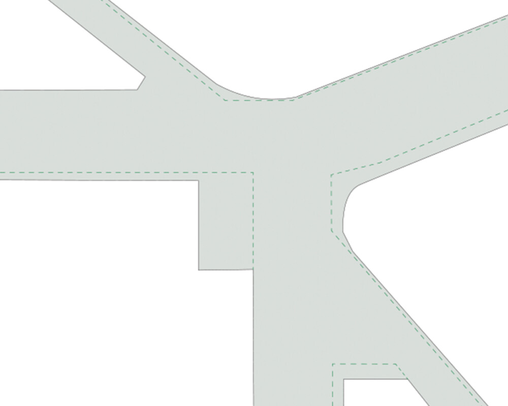
Context
Understand the context within which the intersection functions. Analyze its urban design qualities and document specific gathering places, landmarks, transit stations, and other drivers of activity. Engage the public in this process, allowing safety concerns and community visions to drive the ultimate redesign.
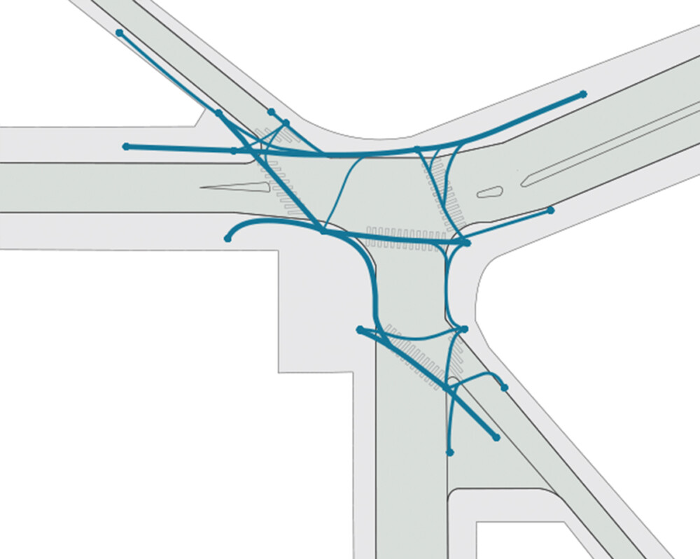
Pedestrian Activity
Document how pedestrians use and activate the intersection as a public space. Where are people gathering, sitting, and talking? What activities are they engaged in? Which public spaces attract people and which do not? Where do people actually cross the street? In urban locations with continual activity, this step can often be accomplished by 15–30 minutes of observation.
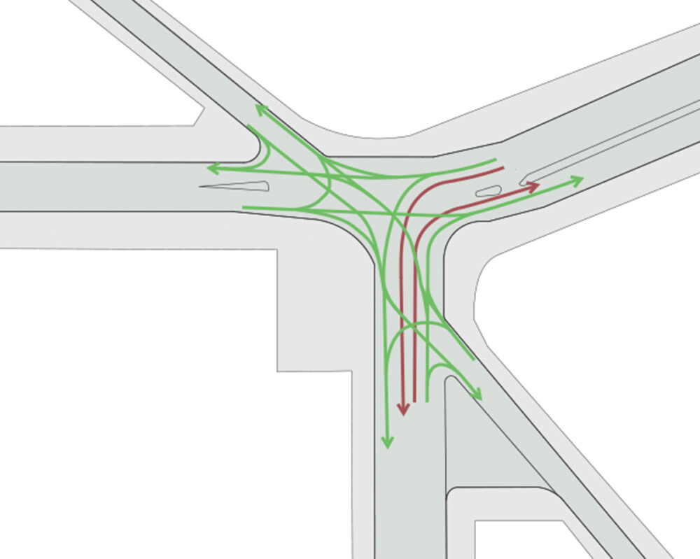
Transit and Cycle Activity
Assess the volume and movement of cyclists as part of the planned and existing cycling network. Document bus headways and volumes, as well as the placement and location of bus stops and other transit facilities. Make note of all other modes of collective transport, their boarding and alighting locations, and facilities.
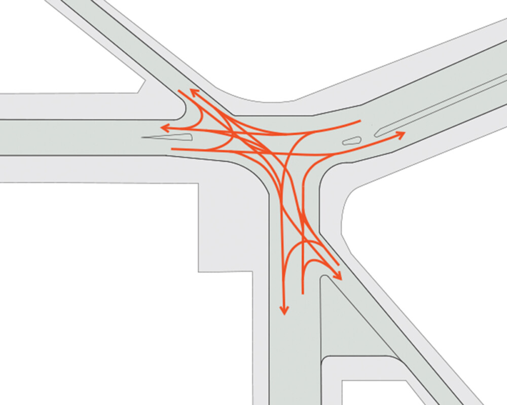
Vehicle Volumes
Map vehicle movements and turns to understand how motorists use the intersection. Overlay volume data to illustrate the relative importance of each movement, looking for low-volume turning movements, in particular. Pair this with observation and understanding of the local planning context and how the street fits into the overall traffic network.
Signalization
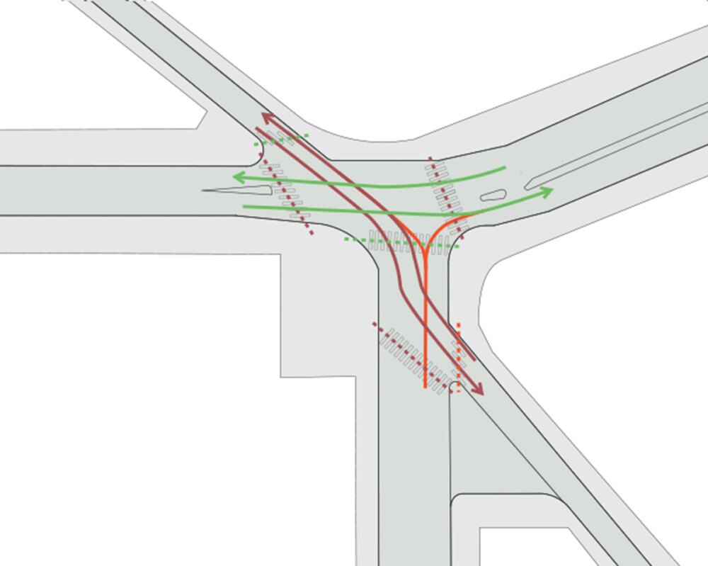
Plot the signal phases to show how the intersection flows. Obtain phasing data from the appropriate agency, or create a general timing plan, ascertained with a stopwatch. Note whether pedestrian and vehicle signals are fixed or actuated. Observe how well the phases match volumes, how people comply, and when signals give priority to drivers, cyclists, or pedestrians.
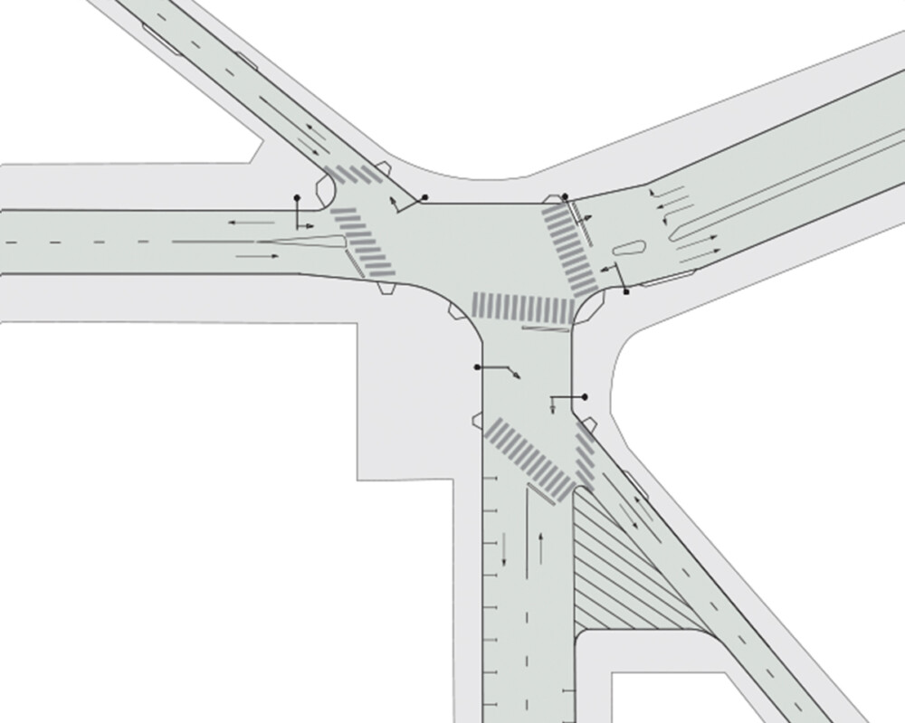
Geometry, Signals,
Signs, and Markings
Survey the intersection’s dynamic conditions, or how people are meant to move through the junction based upon existing markings and geometry.
Adapted by Global Street Design Guide published by Island Press.
Next Section —